Sydney Light Rail: Lines, Fares and Stops Explained for Visitors
Sydney's light rail is the easiest way to reach the fish market, Darling Harbour, Chinatown, Randwick and the Eastern Beaches fringe without touching a bus timetable. Here is how the four lines work, what a ride costs, and where each stop actually takes you.
Short answer
Sydney runs four light rail lines: L1 Dulwich Hill, L2 Randwick, L3 Kingsford and L4 Westmead to Carlingford. A ride costs the same as a bus, from A$3.30 peak for a short hop, and an Opal card or contactless bank card caps at A$19.30 a day Monday to Thursday and A$9.65 Friday to Sunday. Trams run from early morning to late evening, and the L2 and L3 lines pass right by some of the city's best eating.
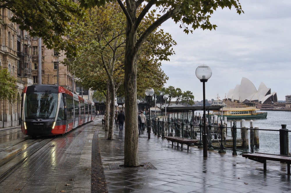
Sydney's trams look modern, gliding silently past sandstone pubs and fig trees, but they run on a piece of transport history: this city once had one of the largest tram networks in the world before it was torn up mid-last-century. The current network is small by comparison, four lines and growing, yet for a visitor it punches well above its size. The L1 line delivers you to the new Sydney Fish Market at Blackwattle Bay, the L2 and L3 lines thread through Surry Hills and past Central to the eastern suburbs, and every line shares a spine through the middle of the CBD where most visitors stay.
This guide covers the whole network: what each line is, what a ride costs, how light rail compares with the buses and ferries, and which stops are worth getting off at even when you have no destination in mind. Everything here comes from Transport for NSW's published fare tables and operating information, so you can plan with real numbers rather than guesses.
What Is the Sydney Light Rail Network?
Sydney's light rail is a modern tram network of four lines, numbered L1 through L4, running on dedicated tracks separated from most road traffic. The L1 runs from Central through Darling Harbour, Chinatown and the inner west; the L2 and L3 share a corridor from the CBD through Surry Hills before splitting toward the eastern suburbs; the L4 runs in Parramatta, in the city's west. Trams are fully accessible with level boarding at every stop, and you tap on and off exactly as you would on a bus.
The network is operated as part of Transport for NSW's integrated fare system, which matters more than it sounds. A light rail trip is not a separate ticket: it charges to the same Opal card or contactless bank card as every train, bus and ferry, shares the same daily and weekly caps, and earns the same transfer discount when you switch between transport types within an hour. If you have already read our opal card guide for visitors, you know the mechanics; the light rail simply plugs into them.
A little history explains the geography. Sydney dismantled its original tram network in the middle of the last century, and the lines that returned had to be rebuilt along corridors the roads had long since claimed. That is why the L1 runs down the middle of pedestrianised Haymarket streets and why the CBD section feels more like a European tram strip than a commuter line: the tracks were laid back into spaces cars had given up.
The newest addition is the L4, which opened on 20 December 2024 as part of the Parramatta Light Rail project, running from Westmead to Carlingford through the Parramatta CBD. It is a genuine second network rather than an extension, and it is already reshaping how people move through Sydney's second CBD, as our parramatta guide explains in more detail.
Where Does the Light Rail Actually Go?
The L1 runs from Central station through Darling Harbour, Haymarket and the inner west to Dulwich Hill, with stops at the Sydney Fish Market, Star Casino and Lewisham. The L2 and L3 run from Circular Quay through the CBD and Surry Hills before splitting, with the L2 ending at Randwick and the L3 at Kingsford, both near the University of NSW. The L4 serves Parramatta, Westmead and Carlingford in Western Sydney. Visitors will mostly ride the L1 and the shared L2/L3 CBD section.
For most travellers the interesting part is what sits within a short walk of each stop. The fish market stop is the standout: the new Blackwattle Bay building opened to the public in January 2026, with more than forty retailers, wholesale floors and dining under one roof, and the light rail is the simplest way to reach it from the city. Our sydney fish market guide covers the move from the old Pyrmont site, which older guidebooks still point to.
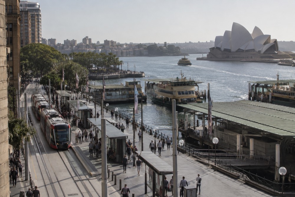
The CBD spine is shared by the L2 and L3 and runs past Town Hall, through the Queen Victoria Building precinct and down George Street, which was closed to cars specifically to let the trams through. George Street between Circular Quay and Central is now one of the better urban walks in the city, partly because the tram made it pedestrian-friendly. Our sydney cbd and queen victoria building pages cover what to do along it.
Here is the full network at a glance:
| Line | Route | Key stops for visitors | Where it helps you |
|---|---|---|---|
| L1 Dulwich Hill | Central to Dulwich Hill | Chinatown, Darling Harbour, Sydney Fish Market, Star, Lewisham | Fish market, Darling Harbour, Chinatown |
| L2 Randwick | Circular Quay to Randwick | QVB, Town Hall, Central, Surry Hills, Moore Park, Randwick | Eastern suburbs, events at Moore Park |
| L3 Kingsford | Circular Quay to Kingsford | QVB, Town Hall, Central, Surry Hills, UNSW, Kingsford | University, Anzac Parade eateries |
| L4 Westmead to Carlingford | Westmead to Carlingford | Parramatta CBD, Westmead hospital precinct | Western Sydney, Parramatta |
The L2 and L3 matter for one more reason: Moore Park. Stadium concerts and big sporting events at the Sydney Football Stadium and the Sydney Cricket Ground funnel crowds onto these trams, and the lines run extra services on event days. If your trip coincides with a match, the light rail is usually faster than a rideshare out of the precinct.
If you are building a sightseeing day around the tram spine, the stops at Darling Harbour and the QVB sit within walking distance of several of the big-ticket attractions, and pairing them with a harbour cruise is a natural combination. The picks above are the products our readers most often bundle with a CBD transport day: the attractions pass, a harbour sightseeing cruise and a food tour that starts close to the tram line.
How Much Does a Light Rail Ride Cost?
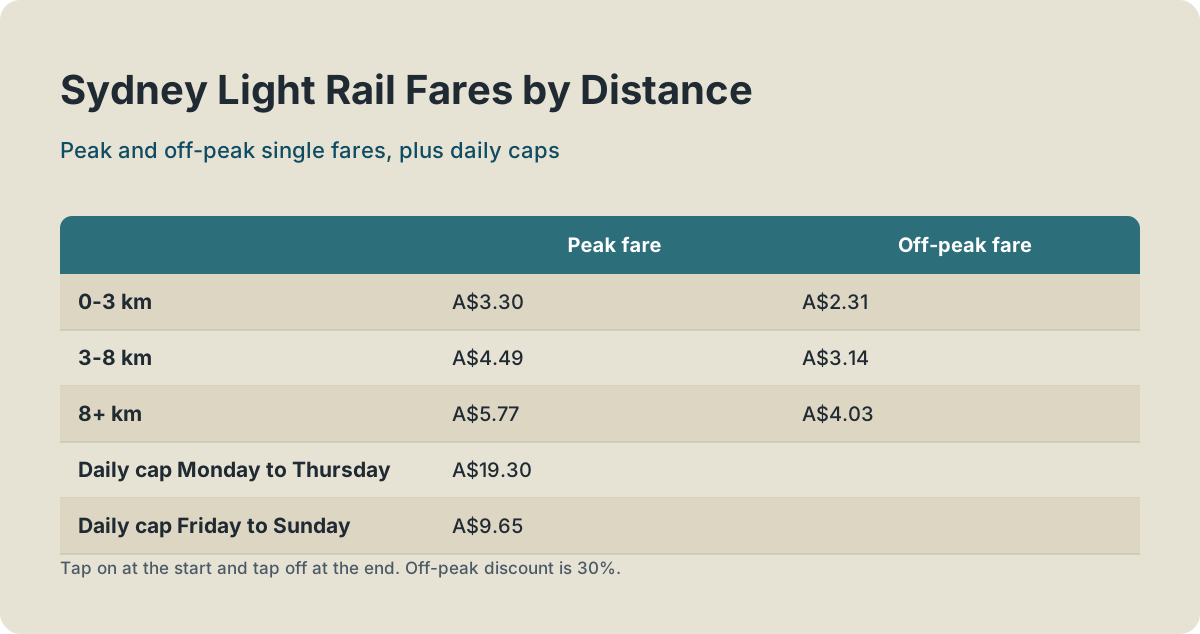
A light rail trip costs exactly the same as a bus trip: from A$3.30 for a journey under 3 km in peak time, A$4.49 for 3 to 8 km, and A$5.77 for anything longer, with a 30% off-peak discount on Fridays, weekends, public holidays and outside weekday peaks. Daily caps apply across the whole network at A$19.30 Monday to Thursday and A$9.65 Friday to Sunday. Tap on at the start and tap off at the end.
The fare bands are published by Transport for NSW on its adult Opal fares page, and light rail shares the bus bands rather than the train bands. Here they are in full:
| Distance | Peak fare | Off-peak fare |
|---|---|---|
| 0-3 km | A$3.30 | A$2.31 |
| 3-8 km | A$4.49 | A$3.14 |
| 8+ km | A$5.77 | A$4.03 |
Two rules do the heavy lifting for visitors. First, the off-peak discount is 30% and applies on light rail, buses, trains and metro on Fridays, weekends and public holidays, and outside weekday peak windows; it does not apply to ferries. Second, the caps are network-wide: a tram in the morning, a ferry at lunch and a train back to your hotel all feed the same daily cap. A public holiday is the cheapest day to travel widely, because the A$9.65 cap applies.
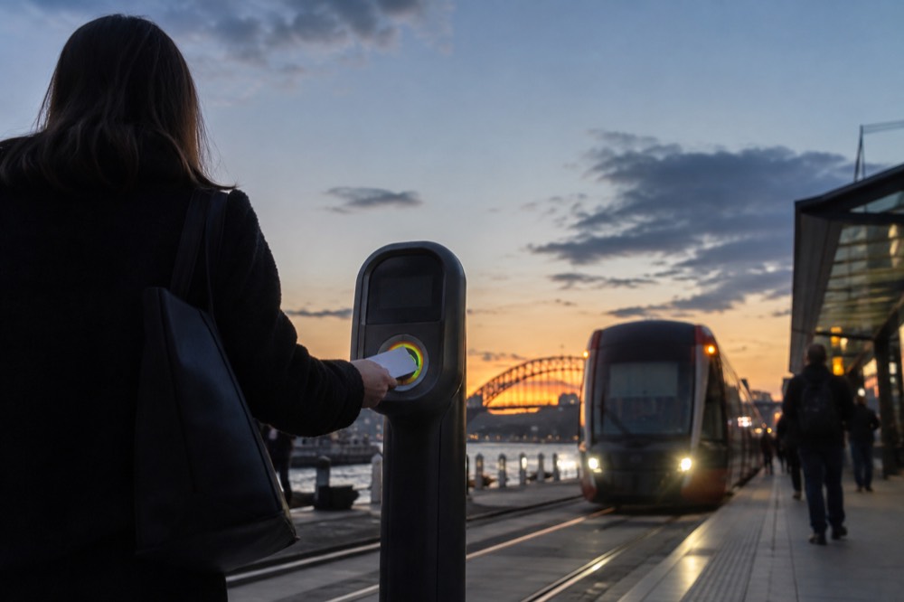
You do not need a physical Opal card at all. A contactless Amex, Mastercard or Visa card, or a phone or watch, is charged exactly what an Adult Opal card is charged, with every cap and discount included. The only trap is the Opal single trip ticket sold at machines: it costs more and earns no benefits, so treat it purely as a backup. Our page on tapping a credit card instead of Opal goes through the edge cases, including what happens if two people try to share one card.
One thing light rail does not do is reach the airport. The airport stations carry a separate access fee on top of the train fare, and no tram line serves them; our sydney airport to the city guide covers the train, the 400 bus and everything else.
If your tram day is really an attractions day, the four-attraction combo pass covering SEA LIFE Sydney Aquarium, Sydney Tower Eye, WILD LIFE Sydney Zoo and Madame Tussauds is worth a look before you buy individual tickets.
The pass runs from US$35.79 and, unlike a single ticket, it can be cancelled up to 24 hours ahead, which suits a tram-based itinerary where the weather might change your plans. SEA LIFE Sydney sits right on the Darling Harbour tram corridor, so the geography works in its favour.
How Does Light Rail Compare with Buses, Trains and Ferries?
Light rail is the best choice for short-to-medium trips along its fixed corridors, especially Darling Harbour, Chinatown, the fish market and Surry Hills, where it avoids traffic entirely on its own right of way. Buses cover far more of the city but sit in traffic; trains are faster over long distances; ferries exist for the harbour, not for commuting. All four share one fare system, one set of caps and one card, so choosing between them costs nothing except time.
The comparison that matters for a visitor is speed and reliability, not price, because the price is identical across modes for the same distance. A tram down George Street or along the Dulwich Hill corridor keeps its own lane and its own schedule. A bus doing the same trip on the parallel roads does not. That predictability is why locals ride the L2 and L3 to Moore Park events rather than driving.
| Mode | Best for | Watch out for | Fares |
|---|---|---|---|
| Light rail | Darling Harbour, fish market, Surry Hills, Randwick | Fixed corridors only, no airport | Bus bands, off-peak discount applies |
| Bus | Everywhere the trams do not go | Traffic on main roads | Same bands as light rail |
| Train / metro | Long distances, the North Shore, airport | Airport access fee at airport stations | Train bands, off-peak discount applies |
| Ferry | Manly, Taronga Zoo, harbour suburbs | No off-peak discount, weather | Flat A$7.35 or A$9.20 by distance |
The ferry row deserves its asterisk. The public ferries are part of the same Opal system with the same caps, but they charge flat distance fares rather than bands and never get the off-peak discount. The privately run Manly Fast Ferry is a different trap entirely: it accepts Opal cards through OpalPay, but at different fares and without the caps and transfer discounts, which catches out visitors who assume they have hit their daily limit. Our sydney ferries guide separates the two properly.
For day trips the tram is irrelevant and the train takes over: the Blue Mountains, the Central Coast and Wollongong are all rail territory. But within the city's inner ring, the light rail plus a ferry makes a genuinely pleasant car-free day, and our do I need a car in Sydney piece concludes, for most visitors, no.
Which Stops Are Worth Getting Off At?
Five stops justify a detour on their own: the Sydney Fish Market stop for the new Blackwattle Bay market, Chinatown for the night food scene, Surry Hills for brunch and bars, Circular Quay as the L2/L3 terminus beside the harbour, and Randwick for the races and the Royal Randwick precinct. Every one of them is also within a short walk of something in our neighbourhood guides, so the tram doubles as a self-guided tour of central Sydney.
Start at the bottom of the L1. The fish market stop drops you a few minutes' walk from a building that only opened in January 2026, so any guidebook older than that is sending you to the wrong address. Back toward the city, the Darling Harbour stop serves the aquarium, the convention precinct and the maritime museum cluster; the Chinatown stop puts you in Dixon Street with the night markets; and the Central terminus connects to every train line in the state.
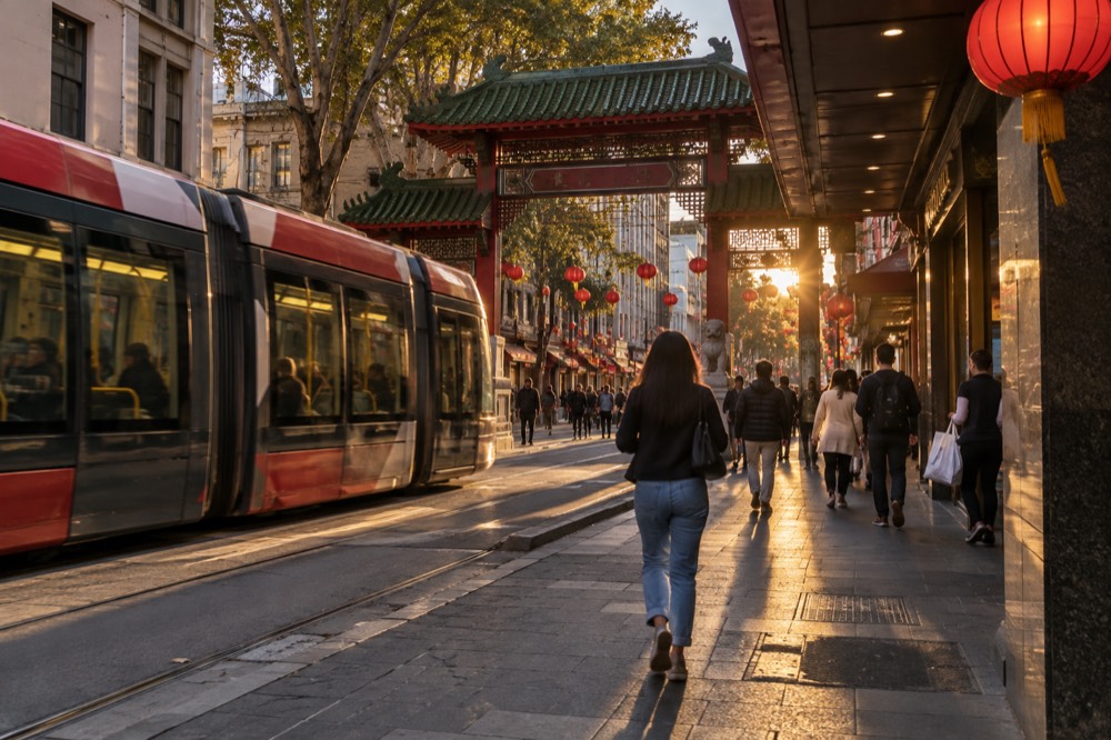
The L2 and L3 corridor is the food corridor. Surry Hills, with its brunch spots and small bars, sits between the Central and Moore Park stops; our surry hills and sydney brunch spots guides map the good ones. Further out, the Anzac Parade stops serve some of the best Korean and Chinese eating in the city at prices the CBD cannot match.
| Stop | Line | Walk to |
|---|---|---|
| Sydney Fish Market | L1 | New Blackwattle Bay market, 40+ retailers |
| Chinatown | L1 | Dixon Street, Paddy's Markets, chinatown sydney precinct |
| Darling Harbour | L1 | SEA LIFE, WILD LIFE, maritime museum, darling harbour |
| Circular Quay | L2, L3 | Opera House, ferries, circular quay |
| Surry Hills | L2, L3 | Brunch strip, small bars, galleries |
| Moore Park | L2, L3 | Sydney Cricket Ground, Sydney Football Stadium |
| Randwick | L2 | Royal Randwick racecourse, The Spot dining strip |
A food tour is the natural upgrade to a Surry Hills or Chinatown tram stop: the six-tasting Secret Food Tours walk runs from US$123.62 and covers ground the tram corridor passes but does not explain.
The tour's route through the inner-city food precincts pairs neatly with a day spent riding the L1 and L2, and it is a good hedge against choosing the wrong restaurant on a short trip.
What Should You Know Before Your First Ride?
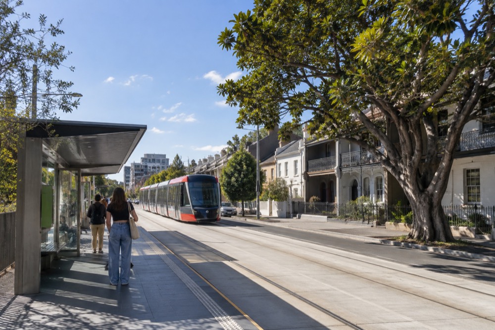
Tap on with your card or phone at the reader on the platform or aboard, and tap off at the end of every trip, because an untapped trip is charged at the default maximum fare. Trams run from roughly 5am to around 1am daily, with higher frequencies in peak hours and a tram every few minutes on the shared CBD section. Stops are announced and displayed, level boarding makes every stop wheelchair and pram accessible, and bikes are permitted outside peak hours.
Frequency is the light rail's quiet strength. On the shared George Street spine, the L2 and L3 combine to give the CBD a tram every few minutes for most of the day, which means you never plan around a timetable there. Further out toward Dulwich Hill or Kingsford the gaps widen, but the Transport for NSW trip planner shows live arrivals for every stop, and the Opal Travel app does the same.
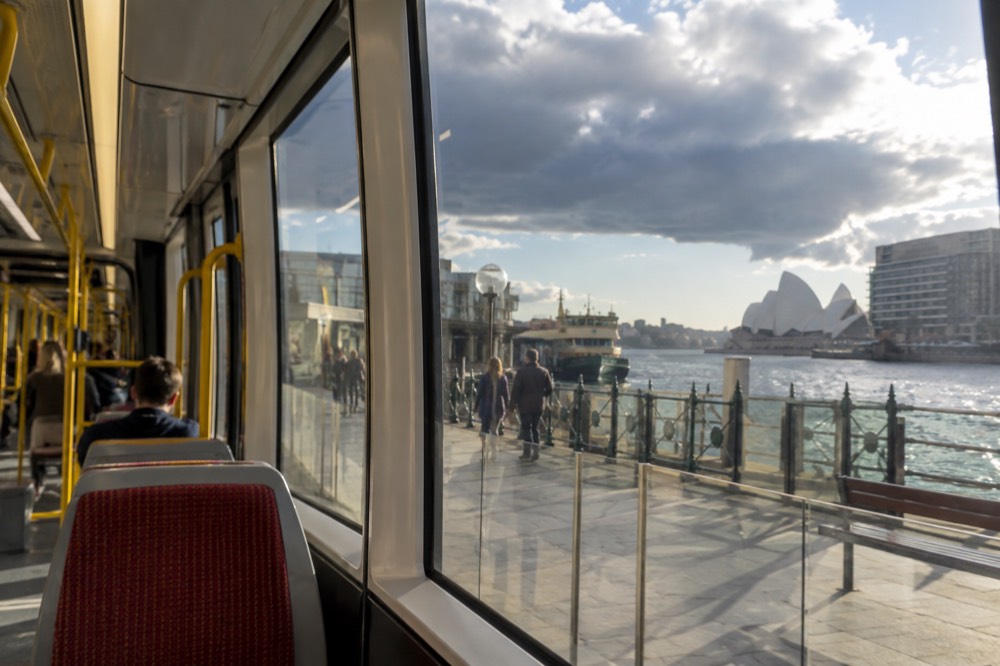
A few practicalities catch visitors out. The platforms in the CBD are in the middle of pedestrianised streets, so watch for trams when crossing: they are quiet and they cannot swerve. Validate your tap even if the reader looks optional, because fare inspections happen and an unvalidated trip is treated as fare evasion, not an honest mistake. And if you are riding to an event at Moore Park, leave at the final whistle or enjoy a post-match drink, because the crowd at the stops after a stadium event is large and patient queueing is the local norm.
The infographic below compresses the fare structure into one view: the three distance bands, the peak and off-peak prices, and where the daily caps sit.
One rule change worth knowing while you are on the streets: private e-scooters remain illegal on NSW roads, footpaths, shared paths and bike lanes, with shared-scheme trials limited to designated areas, per Transport for NSW's e-scooter rules page. The light rail corridors are exactly the kind of wide, flat paths that tempt people to ride one; do not, because the penalty is real and the trams are faster anyway.
What Is Changing on the Network?
The Parramatta Light Rail Stage 2 extension is funded and in procurement but not open, the Sydney Metro's Sydenham to Bankstown extension is due to open in late 2026, and Western Sydney International Airport begins passenger flights on 25 October 2026 with its own metro line tied to the opening. None of these change the four existing light rail lines, but two of them reshape the wider network enough that a guide written a year ago is already out of date.
The L4 is the line to watch. Stage 2, running from the Parramatta CBD toward Wentworth Point, is confirmed in the 2026-27 budget with construction and procurement underway, but it is years from carrying passengers. In the meantime the Stage 1 line has already changed Parramatta's street life noticeably, and it connects with the T-way bus network and the train lines at Westmead and Parramatta stations.
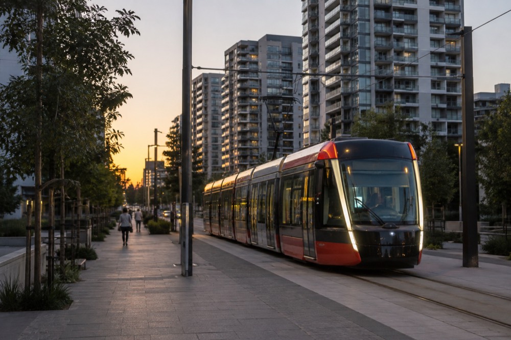
The metro matters to light rail riders because of Central station. The Metro M1 already runs from Tallawong to Sydenham, and the Southwest extension to Bankstown was in final trial running, targeting an opening in late 2026 pending regulatory approvals. Central is the interchange where metro, light rail, trains and buses converge, so an expanded metro simply makes the tram network easier to reach from more of the city. Our sydney trains for visitors page tracks the rail side of this.
For a visitor, the practical takeaway is simple: the tram map you download today will still be valid for your trip, but any guide claiming the metro already reaches Bankstown, or that the fish market is still at Pyrmont, was written before the ground moved. The Sydney Travel Guide keeps both of those current.
Should You Ride the Light Rail Just for the View?
Yes, for two stretches: the L1 along the Darling Harbour and Blackwattle Bay waterfront, where the tracks run past the water and the new fish market, and the shared L2/L3 section down George Street, which was pedestrianised for the tram and is now one of the city's better street-level experiences. Neither is a scenic railway, but both beat a bus window, and the Circular Quay terminus puts you at the harbour's edge with the Opera House in view.
The George Street ride is the surprise. Because the street was closed to cars, the tram glides past the QVB, Town Hall and a run of heritage facades at walking pace, and you see the city's main retail spine the way pedestrians do. At Circular Quay you step off with the harbour in front of you, which is about the best terminus view on the network.
If you want the harbour itself, the tram gets you to the wharf and the ferry does the rest. A sightseeing cruise from Circular Quay or Darling Harbour, from US$28.53 for a 90-minute loop, is the classic pairing with a tram day, and the Darling Harbour and Circular Quay stops serve it directly.
Morning and afternoon departures both work with the tram's frequency, and the cruise's Circular Quay departure point is a two-minute walk from the L2 and L3 terminus, which makes the logistics almost self-planning.
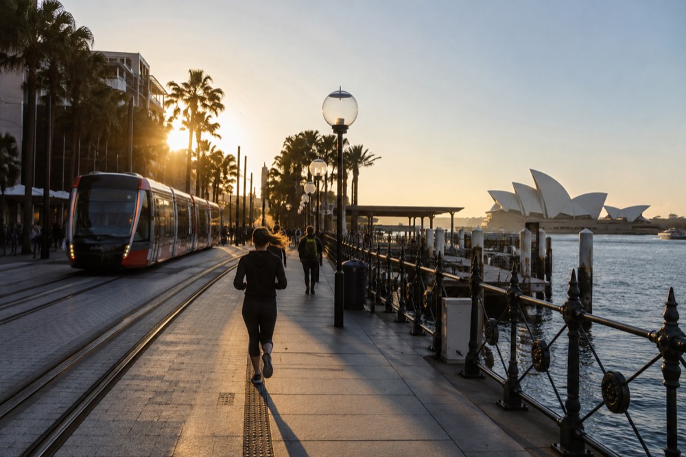
For a full day built this way, tram to Darling Harbour in the morning, cruise at midday, tram back through Chinatown for a late lunch, and finish in Surry Hills as the small bars open. Our 1 day in sydney itinerary uses exactly this spine.
Whichever pieces you book, the transport underneath it all costs the same flat daily cap, so the only real decision is what you want to look at.
Common Questions About the Sydney Light Rail
How much does the Sydney light rail cost?
Light rail charges the same distance-band fares as buses: A$3.30 peak for trips under 3 km, A$4.49 for 3-8 km and A$5.77 beyond that, with a 30% off-peak discount on Fridays, weekends, public holidays and outside weekday peaks. Daily caps of A$19.30 Monday to Thursday and A$9.65 Friday to Sunday apply across the entire Opal network.
Can I tap my credit card on the Sydney light rail?
Yes. A contactless Amex, Mastercard or Visa card, phone or watch is charged exactly what an Adult Opal card is charged, including all caps, discounts and transfer benefits. Only the Opal single trip ticket sold at machines costs more and earns nothing.
Does the light rail go to the Sydney Fish Market?
Yes. The L1 Dulwich Hill line stops at the Sydney Fish Market, a short walk from the new Blackwattle Bay building that opened in January 2026. The old Pyrmont site is closed; any guide directing you there is out of date.
Does the Sydney light rail go to the airport?
No. No light rail line serves either airport terminal. The train from the airport stations carries a separate access fee on top of the fare, while the 400 bus avoids it; our Sydney [airport to the city](https://kiwitaxi.tpk.ro/TtV4BOjc) guide compares the options.
How often do Sydney trams run?
On the shared CBD section the L2 and L3 combine to give a tram every few minutes for most of the day. Services run from roughly 5am to around 1am daily, with extra services on Moore Park event days and longer gaps on the outer ends of the L1.
Is the Sydney light rail accessible?
Yes. Every stop has level boarding with no steps, trams have dedicated spaces for wheelchairs and prams, and stop displays and announcements serve every service. The network is one of the more accessible ways to move through central Sydney.