Spit to Manly Walk: A Complete Guide to Sydney Harbour's Best Coastal Trail
The Spit to Manly walk is the harbourside trail Sydneysiders keep for themselves: sandstone cliffs, hidden beaches, Aboriginal engravings and a ferry ride home.
Short answer
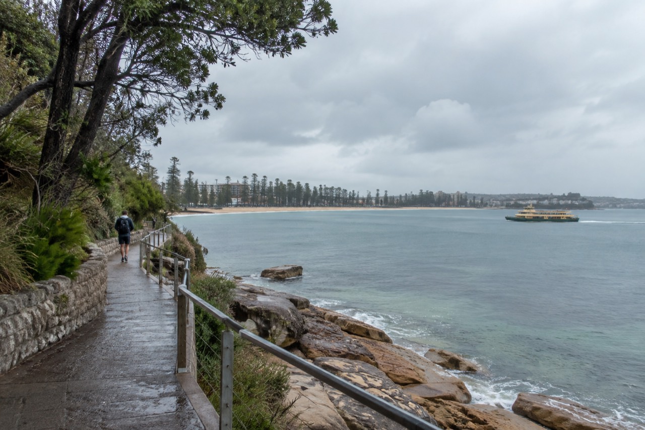
The Spit to Manly walk is Sydney Harbour National Park's signature shoreline trail, running from The Spit bridge at Middle Harbour to Manly Wharf. It passes Grotto Point, Dobroyd Head and Reef Beach, with harbour views almost the entire way, and finishes with the ferry back to Circular Quay. Allow a half day, start early, and check patrol flags before swimming.
The Spit to Manly walk does something almost no other city trail manages: it spends its entire length inside a national park while never leaving the sights and sounds of a working harbour. Ferries slide past the sandstone below you, kayakers cross the bays, and the Sydney skyline sits quietly on the horizon the whole way. Locals treat it as their default weekend walk, and visitors who discover it tend to rank it above the more famous coastal walks within a day of arriving. This guide covers what you will see, how to get to the start, when to go, where it is safe to swim, and how to finish the day properly in Manly.
What Is the Spit to Manly Walk?
The Spit to Manly walk is the main section of the Manly Scenic Walkway, a signed trail through Sydney Harbour National Park that follows the shoreline of the northern side of the harbour entrance. It starts at The Spit bridge at Middle Harbour and ends at Manly Wharf, crossing headlands, pocket beaches and patches of protected bushland the whole way. The land is part of the traditional country of the Aboriginal peoples of the Sydney region, and the engravings along the trail are among the reasons it is protected.
The trail is managed by NSW National Parks as part of Sydney Harbour National Park, the same park that covers North Head, Bradleys Head and parts of the harbour foreshore around Mosman. That matters for two practical reasons. First, the bushland is genuinely protected, so the vegetation along the track is closer to what the harbour looked like before the city than almost anywhere else you can walk. Second, some sections of the park carry vehicle entry fees, though the walk itself is entered on foot and the sections this trail passes through are not among the fee-charged areas listed by the park service.
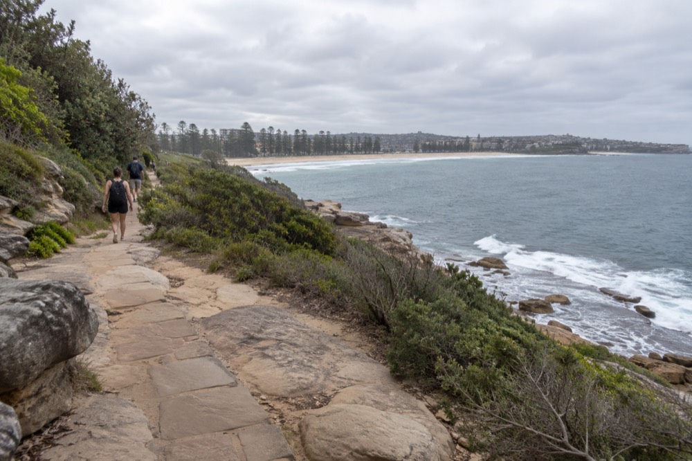
The walk's character changes constantly, which is why people who do it once tend to do it again. There are long open stretches on exposed headlands where the harbour spreads out in front of you, quiet sections under eucalypts where you hear water and birds rather than traffic, and short urban passages near the start and finish where a coffee is never far away. It is a walk of small bays rather than one long beach, and each bay has its own personality: some are swimming spots, some are just photo stops, and a couple are places you will want to linger at for an hour without planning to.
Because the finish is Manly Wharf, the logistics work in your favour. You walk one way, then catch the ferry back to the city, which means the return leg is itself one of Sydney's great experiences rather than a commute. The Manly ferry guide covers that crossing in detail, including the fare and how the Opal cap applies.
What Will You See Along the Way?
The highlights are Grotto Point with its Aboriginal rock engravings and harbour panorama, the clifftop lookouts of Dobroyd Head, and a chain of small beaches including Reef Beach and Washaway Beach, each with a different angle on the harbour entrance. You will also pass Crater Cove's historic fisherman's cottages, lookouts straight down the channel to the Heads, and, in season, whales passing offshore. The engravings are the section most walkers remember longest.
Grotto Point sits early enough in the walk that you reach it before your legs are tired, and it delivers the single best view of the trail: the full sweep of the harbour entrance with the open ocean beyond it. The Aboriginal engravings nearby are genuine and protected, and the National Parks service asks visitors to look without touching, since foot traffic and rubbing wear the grooves away. Treat them as the reason the headland is protected rather than as a photo opportunity.
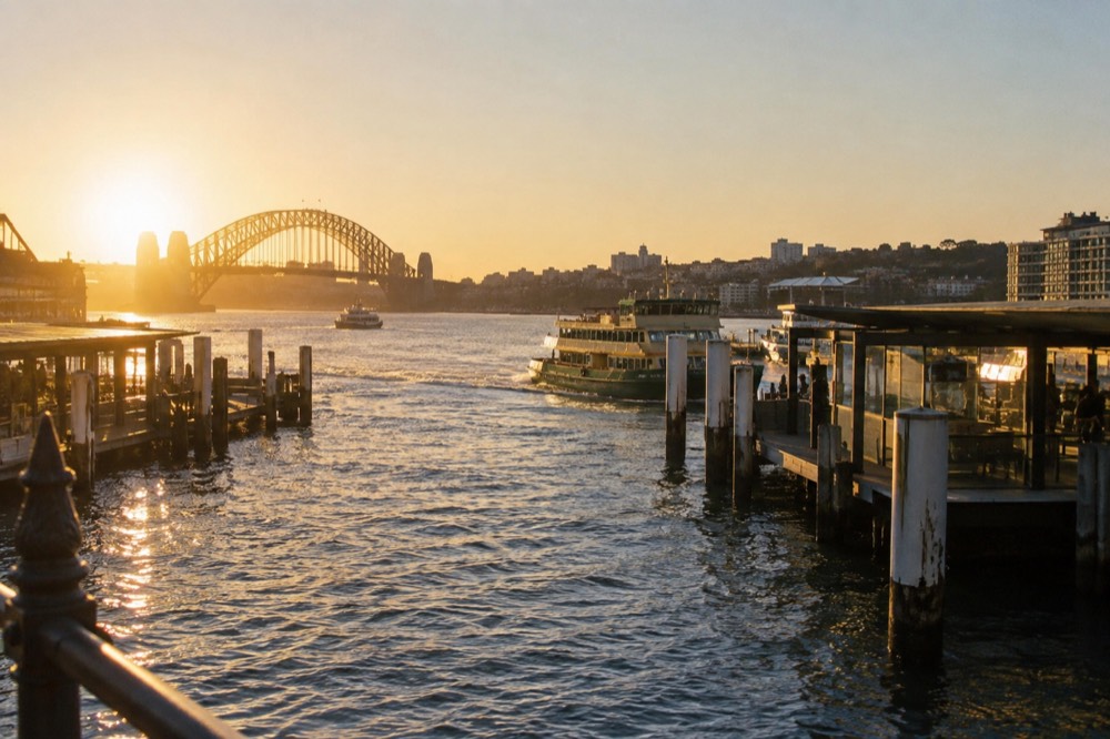
Dobroyd Head follows, and its clifftop lookouts face straight down the channel that every ship entering or leaving Sydney Harbour passes through. On a clear afternoon you can watch the ferries, yachts and occasionally a cruise ship thread the gap. Crater Cove below holds a small group of heritage cottages perched impossibly on the water's edge, a remnant of an era when fishermen built shacks on harbour land nobody else wanted.
The beaches in between are the walk's secret. Reef Beach is sheltered and calm, Washaway Beach is exactly what its name promises in big swell, and the swimming spots near Manly at the end, including Shelly Beach, are among the safest and prettiest in the city. None of these are the big-surf ocean beaches of the Northern Beaches; they are harbour beaches, which means calm water, sandstone instead of dunes, and a swimming experience that suits most visitors better than the open coast does.
If walking the shoreline gives you a taste for being on the water rather than above it, the harbour sunrise kayak tour covers the same Middle Harbour bays from sea level. It is rated 4.95 across 2,606 reviews, runs from US$120.96, and starts early enough that you could paddle in the morning and walk the trail in the afternoon.
The trail also connects into a bigger network if you want more. From Manly you can continue around to Manly Beach and the ocean front, or extend toward North Head's quarantine station precinct, which is part of the same national park and adds a genuinely historic layer to the day.
How Do You Get to the Start at the Spit?
The easiest way is by ferry and bus: catch any ferry or bus to the city, then a bus from the CBD toward Manly that stops at The Spit, or take the ferry to Manly first and do the walk in reverse. Driving works on weekends but parking at The Spit is limited and fills early. The walk itself is free, on foot, through sections of Sydney Harbour National Park that do not charge an entry fee.
Starting at The Spit and finishing at Manly is the popular direction because the ferry home from Manly Wharf is the reward. If you are already staying in Manly, doing it in reverse works just as well and puts the ferry at the start of your day instead. Either way, the transport is the same network: Transport for NSW runs the buses along Military Road to The Spit, and the F1 ferry connects Manly to Circular Quay.
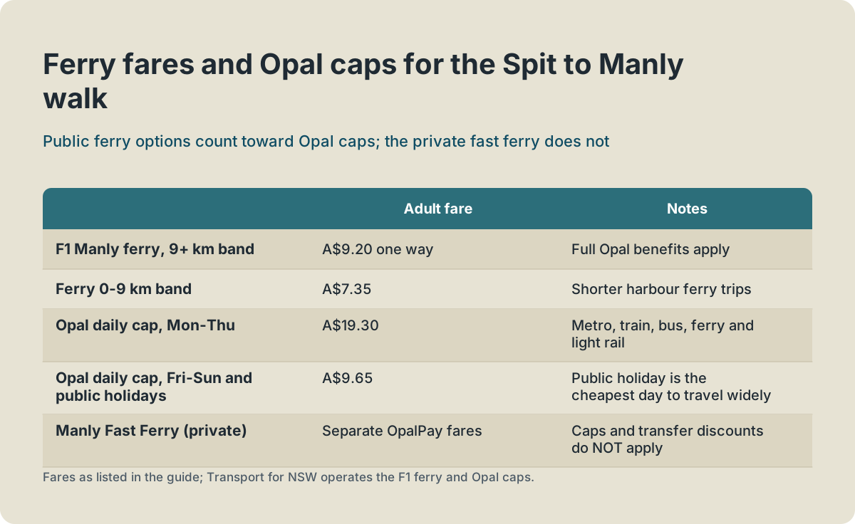
| Ferry option | Adult fare | Notes |
|---|---|---|
| F1 Manly ferry, 9+ km band | A$9.20 one way | Public Sydney Ferry, full Opal benefits apply |
| Ferry 0-9 km band | A$7.35 | Shorter harbour ferry trips |
| Opal daily cap, Mon-Thu | A$19.30 | Applies across metro, train, bus, ferry and light rail |
| Opal daily cap, Fri-Sun and public holidays | A$9.65 | A public holiday is the cheapest day to travel widely |
| Manly Fast Ferry (private) | Separate OpalPay fares | Opal caps and transfer discounts do NOT apply |
The fare table matters more than it looks. The public F1 ferry is in the 9+ km distance band at A$9.20 one way, and it counts fully toward your Opal daily cap, so a day built around the ferry and a couple of buses is capped the same as any other transport day. The privately operated fast ferry is the trap: it accepts the Opal card through OpalPay, but the caps and transfer discounts do not apply, so a visitor who assumes they have hit the daily cap keeps paying. Transport for NSW publishes the full fare and cap details on its adult Opal fares page.
One planning note worth the walk's own section: check the weather before you commit, because the exposed headland sections have almost no shelter, and the trail's sandstone steps become slippery after rain. More on the seasons below.
When Is the Best Time of Year to Do the Walk?
The best months are August through November: winter's rain has passed, August is statistically Sydney's clearest month with 13.4 mean clear days, and the whale migration runs May to November with the southern migration bringing whales closest to shore from August. Avoid June if you can, it is Sydney's wettest month at 133.1 mm on average, wetter than any summer month. Start early in warm months and carry more water than you think you need.
Sydney's rainfall pattern surprises almost everyone who has not looked at the actual Bureau of Meteorology data. The long-run averages from the Observatory Hill station show rainfall peaking in autumn and early winter, not summer: June averages 133.1 mm, more than any other month, while February, the middle of the tourist high season, is the cloudiest month of the year with just 5.3 mean clear days. August, by contrast, is the clearest month on record with 13.4 clear days on average. The visitor who assumes an Australian coastal city is at its best in summer is choosing Sydney's statistically cloudiest, most humid stretch.
| Month | Mean max °C | Mean rainfall mm | Rain days (1mm+) | Mean clear days |
|---|---|---|---|---|
| Jan | 26.0 | 101.2 | 8.6 | 6.8 |
| Feb | 25.8 | 119.3 | 9.0 | 5.3 |
| Apr | 22.5 | 126.5 | 8.9 | 9.1 |
| Jun | 17.0 | 133.1 | 8.8 | 9.1 |
| Aug | 17.9 | 80.2 | 7.1 | 13.4 |
| Oct | 22.2 | 76.7 | 7.9 | 8.1 |
| Nov | 23.7 | 83.8 | 8.3 | 6.0 |
The table above is drawn from the Bureau of Meteorology's long-term normals for Sydney (Observatory Hill), and it is the basis for the clearest advice this guide can give: if your trip falls in the June-July window, keep this walk flexible and check the forecast rather than locking it in as a fixed plan. If it falls in August through November, book nothing else for that day, because it is close to the best walking weather the city offers anywhere.
Daylight saving is the other seasonal detail worth planning around. NSW clocks move forward on the first Sunday of October and back on the first Sunday of April, which means an October or November walk gives you long evenings and the option of a late ferry home. In the June-July winter window the light goes early, so a mid-afternoon start is not advisable.
Can You See Whales from the Spit to Manly Walk?
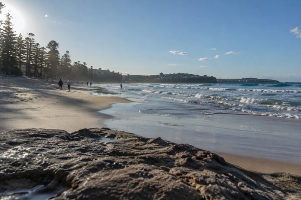
Yes, in season. The NSW whale migration runs May to November, and the headlands on this walk, especially Grotto Point and Dobroyd Head, sit directly on the route whales take through the harbour entrance. The southern migration from August to November brings mothers and calves closest to shore, and the peak for numbers is late June through July. Sightings are never guaranteed, and the season is strictly May to November, so do not expect whales outside those months.
NSW National Parks publishes the migration facts, and they are worth knowing before you stand at a lookout hoping. The northern migration, humpbacks heading to breeding grounds, runs roughly May to July. The southern migration, returning with calves, runs roughly August to November and travels closer to shore, which makes the spring half of the season the better bet from a clifftop. An estimated 40,000-plus humpbacks migrate along the NSW coast each year, a population recovery figure rather than a count of whales passing any single point, and land-based vantage points inside Sydney Harbour National Park are among the places the park service itself recommends for watching.
Bring binoculars if you have them, and be honest about what a land-based watch is: you are looking for blows, flukes and breaches at distance, not aquarium viewing. If being on the water during the season appeals more than watching from it, the whale watching cruises run from Sydney Harbour through the same months, and the operator's live listing has the current departure details.
If you would rather be in the water than watching it from the trail, the Manly and Shelly Beach snorkelling tour covers the marine reserve at the walk's finish, rated 4.71 across 222 reviews and from US$89.47, and it pairs naturally with a morning walk followed by an afternoon in the water.
Is It Safe to Swim at the Beaches Along the Walk?
The harbour beaches along the trail are calm and sheltered, but you should still swim at patrolled locations during patrol hours, and Manly Beach at the finish is the safest choice because it is patrolled year-round by council lifeguards. Never assume an unpatrolled beach is fine just because the water looks calm: calm water is exactly what a rip current looks like from the sand. The official rule is always to swim between the red and yellow flags.
Sydney's harbour beaches are genuinely calmer than the ocean beaches, and that is why families favour them, but calm-looking water is not the same as safe water. Surf Life Saving's public safety site states the rule plainly: swim between the red and yellow flags at a patrolled beach during patrol hours, and there have been no recorded coastal drowning deaths between the flags in recent seasons. The rip current, the number one hazard on the entire coast, is identified by the official advice as a reason to choose patrolled spots rather than a challenge to work around. If you are caught in one, the published advice is to stay calm, raise an arm and call for help, float with the current which may return you to a sandbank, or swim parallel to the beach toward breaking waves. Beachsafe, Surf Life Saving's own public site, carries the full rip current guidance.
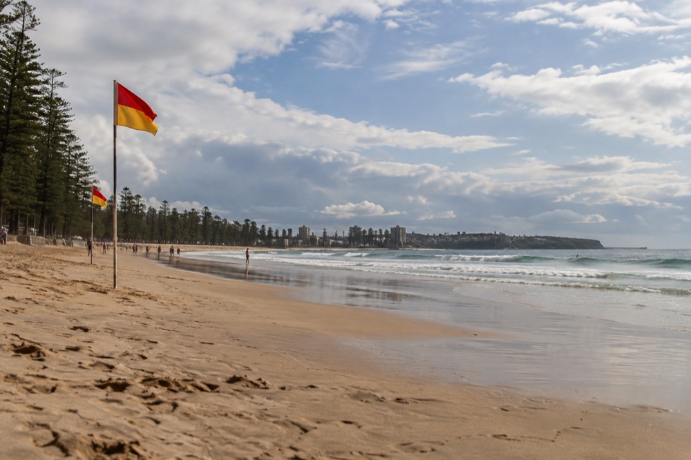
The patrol situation on this walk's beaches is specific and worth knowing. Manly is patrolled year-round by council lifeguards, one of only a handful of Sydney beaches with that status, and the Northern Beaches council publishes its beach patrol information including the seasonal details. The small harbour beaches along the trail itself are not patrolled in the way the main surf beaches are, so treat them as wading and cooling-off spots rather than swimming beaches, and save your proper swim for Manly.
Two more harbour-specific safety notes. First, water quality: the NSW Beachwatch program grades swim sites and advises staying out of the water while it is raining, for up to one day after heavy rain at ocean beaches and up to three days at harbour and estuarine sites, because the harbour's water quality moves with runoff. Second, bluebottles arrive in warmer months and after onshore winds; do not touch them on the sand or in the water, and if stung, leave the water, remove tentacles with seawater rather than bare hands, immerse the sting in hot water around 45 °C for up to 20 minutes, and get a lifeguard if the reaction is severe.
What Should You Pack and Wear for the Spit to Manly Walk?
Pack more water than you expect to need, sun protection for the exposed headlands, and shoes with real grip for sandstone steps that are polished and slippery when damp. The UV index in Sydney passes the protection threshold of 3 for most of the year and reaches extreme levels of 11-plus in summer, so a hat, sunscreen and sunglasses are essentials in every season, not just summer. There are kiosks at the start and finish but long dry stretches in between.
The sun is the detail visitors from the northern hemisphere consistently underestimate. Australia's UV levels are higher than most visitors have experienced at home, and the official guidance from ARPANSA, which operates a Sydney measuring station, is that sun protection is advised whenever the UV index reaches 3 or above. In early spring, a measured Sydney day already peaked at 4.4 by early afternoon. In the December to February summer the index regularly reaches extreme levels. There is no month of the year when you should walk this trail without sunscreen.
| Item | Why it matters on this trail |
|---|---|
| Water, 1.5 litres or more per person | Long dry sections between The Spit and Manly with few refill points |
| Shoes with grip | Polished sandstone steps are slippery when damp, year-round |
| Hat, sunscreen, sunglasses | UV passes the protection threshold most of the year; extreme in summer |
| Swimwear and a towel | Harbour beaches and Manly's patrolled surf beach at the finish |
| Binoculars | Whale season runs May to November; headlands face the migration route |
| A light rain layer | June averages 133.1 mm of rain; showers arrive fast on exposed headlands |
| Opal card or contactless card | Bus to the start, ferry home from Manly Wharf |
Clothing-wise, think layers rather than a single outfit. The headlands are windy even when the city streets are still, and a morning that starts warm can turn cool on Dobroyd Head within minutes. If you are walking in the June-August winter, the means are mild by world standards, 16.4 to 17.9 °C daytime maxima, but the wind off the harbour is the real factor, so a windproof layer earns its place in the pack.
Where Should You Eat and Drink in Manly at the Finish?
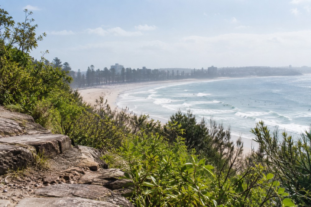
Manly Wharf puts you directly in front of the Corso, the pedestrian strip that runs from the ferry to the ocean beach, and the whole spread is within a few minutes' walk: harbourside seafood near the wharf, the Corso's casual options, and the beachfront strip along Manly's ocean side. The ferry terminal itself has bars and eateries overlooking the water, which is the classic way to end the walk: a drink facing the harbour you just walked around.
The finish is deliberately generous. You arrive at Manly Wharf tired, and everything you need is right there. The Corso runs straight from the ferry terminal toward the ocean beach and is lined end to end with food, from quick counter options to proper sit-down restaurants. Turn left at the wharf for the calm harbour side and its waterfront tables, or walk the Corso through to the surf beach for the oceanfront strip. The Manly ferry guide covers the timetable side of the finish, including how often ferries run back to Circular Quay.
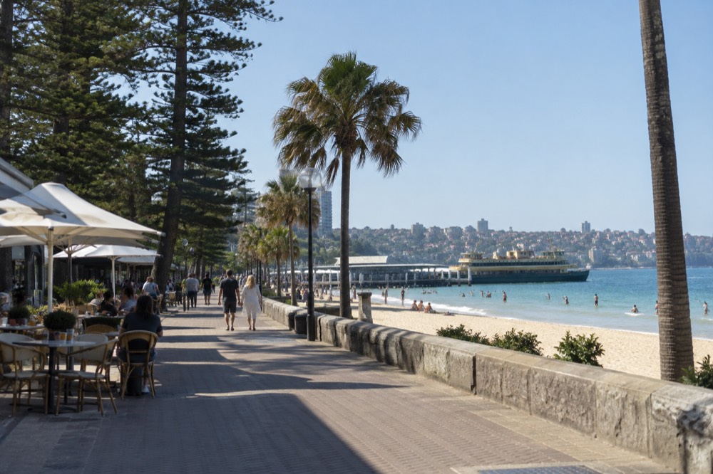
Timing your finish against the ferry is the last piece of planning. The F1 runs frequently through the day, and because it counts toward your Opal cap, the ride home costs nothing extra on a day when you have already used transport to reach The Spit. Sit on the right-hand side leaving Manly for the best of the harbour views on the way back, and if you time a late-afternoon ferry in the warmer months, you get the skyline in golden light as the bonus nobody plans for but everybody remembers.
If the walk has left you wanting more of the harbour rather than less, a sightseeing cruise is the low-effort version of the same view, rated 4.7 across 863 reviews and from US$28.53 for a 90-minute circuit, and the Rocks guided walking tour, from US$36.57 for 90 minutes, is the natural city-side companion if you want the history of the shore you just looked across at all day.
For the full picture of what else the northern side of the harbour offers, the Sydney Northern Beaches guide covers Manly and its neighbours, and the south-side counterpart trails are compared in our broader Sydney coastal walks roundup, which sets this trail against the Bondi to Coogee walk and others. This site's full coverage of the harbour city, including every walk and ferry route, is at Sydney Travel Guide.
Common Questions About the Spit to Manly Walk
How hard is the Spit to Manly walk?
It is a moderate walk rather than a hard one. The trail has steady sandstone steps and some short climbs on the headlands, especially around Grotto Point and Dobroyd Head, but there is no sustained steep section. Most people with reasonable fitness complete it comfortably in a half day with stops. The steps are polished and slippery when damp, so shoes with grip matter more than fitness does.
Can you do the Spit to Manly walk in reverse?
Yes, and it works well. Start at Manly Wharf, walk toward The Spit, and catch a bus back to the city from Military Road. Doing it in reverse puts the ferry at the start of your day instead of the end, and some walkers prefer finishing at the quieter Spit end rather than in busy Manly. The trail is signed in both directions.
Is the Spit to Manly walk suitable for kids?
For school-age children, yes, with the caveats that the headland sections have clifftop edges with only partial fencing in places, and there are long stretches without water or toilets. Families with younger children often walk just the Manly end, around Shelly Beach and the headland, which delivers the best views in a shorter, safer circuit. Save the full trail for kids who can walk a half day reliably.
Do you need to pay to enter Sydney Harbour National Park for this walk?
No entry fee applies to the sections of the walk itself, because you enter on foot and the fee-charged areas of Sydney Harbour National Park are vehicle-based sites such as North Head and Bradleys Head. If you drive and park at a fee-charged precinct, vehicle fees apply: North Head is A$5 per day and Bradleys Head A$8 per day. Arriving by ferry and bus avoids vehicle fees entirely.
Can you swim at the beaches along the Spit to Manly walk?
You can, but choose carefully. The small harbour beaches along the trail are calm and sheltered, yet they are not patrolled like the main surf beaches, so treat them as wading spots. Save your proper swim for Manly at the finish, which is patrolled year-round by council lifeguards, and always swim between the red and yellow flags. Stay out of the water for up to three days after heavy rain at harbour swim sites, per the official Beachwatch advice.
When can you see whales from the Spit to Manly walk?
The NSW whale season runs May to November. The northern migration is roughly May to July, the southern migration with calves, which passes closer to shore, is roughly August to November, and peak numbers come late June through July. The headlands on this walk face the harbour entrance directly, so bring binoculars in season, but never expect a sighting as a certainty.